After six days of relatively mild conditions, a cold front swept down the country on the 28th bringing cold air from the Arctic across most of the country. Although widely predicted, the rapid drop in temperatures was surprising. The chart below plots temperature and dew point readings sent from the Bracken House weather station to Weather Underground, and shows the dramatic fall in temperatures between 09:30 and 10:00.
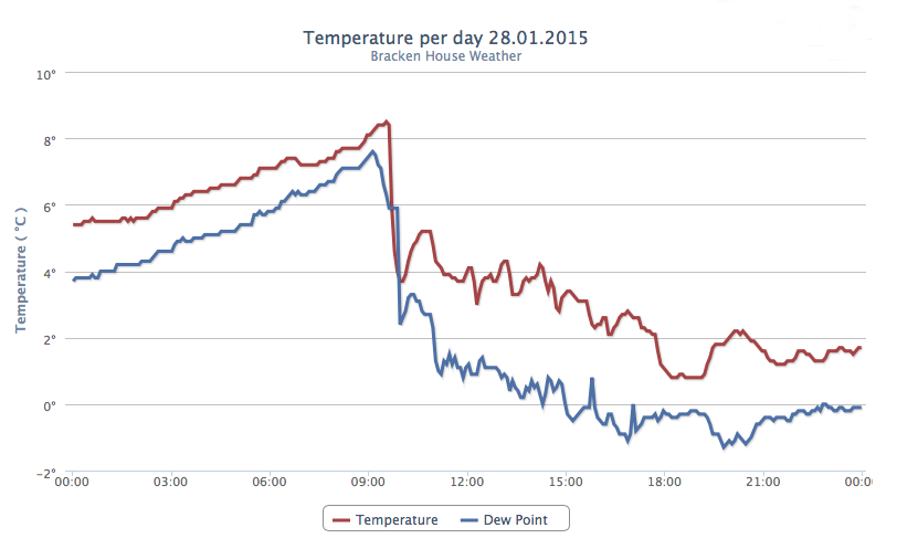
Temperature graph for January 28th 2015.
Between 09:33 and 10:00, the temperature fell from 8.6°C to 3.7°C, a fall of 4.9°C in 27 minutes. As can be seen on the graph, even after the cold front passed, the temperature continued to fluctuate more than usual for the rest of the day, falling to a low of 0.8°C at 18:46.
Overnight and into the 29th, the north-westerly winds brought frequent snow showers and the barometric pressure fell rapidly from 1014.3 millibars at midnight on the 28th to 975.3 millibars at 14:17 on the 29th. The snow showers were only light, giving a maximum snow depth of 1.5 centimetres on the afternoon of the 29th.
Related articles
- Coventry and Warwickshire weather: Cold front from the Arctic heading our way (coventrytelegraph.net)
- The best weather apps for iPhone and iPad (macworld.com)